
Trace a Buffalo Grove Street
A sound Buffalo Grove street directory search moves from geography to names. Property records identify the tax-bill name and parcel, while recorded deeds show parties to transfers. Neither source lists every occupant. The Illinois voter tool can confirm a known registrant when the searcher already has the required personal and address details, but it cannot display every voter on a block. Historical phone books and newspapers add older, dated address links.
- Normalize the house number, unit, street, city, and ZIP with USPS. Keep any older spelling or postal-city form.
- Enter the address in Buffalo Grove Community GIS. Confirm the village and zoning context.
- Open the Lake or Cook assessor search. Record the PIN, situs, tax-bill name, legal description, and year.
- Use county GIS to inspect the parcel and adjoining lots. Search deeds by party, date, and legal description.
- Check village permits and historical sources. Use voter lookup only to confirm a known person.
A parcel identification number, or PIN, is a more stable bridge than a street label. Dates matter too. A deed party, permit applicant, phone subscriber, and current tax-bill name may be different people at different times.
Two-County Buffalo Grove Addresses
Buffalo Grove lies in Lake and Cook Counties. That split decides which assessor, recorder, court, and archive holds a record. A Buffalo Grove postal line alone cannot select the office. The Buffalo Grove Community GIS Portal is the municipal gateway because it begins with a street address and presents property, representative, zoning, map, and tax views.
Lake parcels move to Lake property tax and recording systems. Cook parcels move to the Cook Assessor, CookViewer, and Cook Clerk Recordings. Save township and county with the PIN. This county-first check prevents a false no-result in the street directory. Postal city, ZIP, village boundary, township, county, and legal location remain separate facts. No official source reviewed documented a villagewide street renumbering, so old-number claims should not be guessed.
Buffalo Grove Street Search Fields
The Lake County Property Tax Search supports several routes. Address No and Street form the direct path. Unit and ZIP narrow it. Owner, Billing Name, and Parcel ID are alternatives. Tax-cycle, sort, filter, and results-per-page controls shape the output.
| Field | Use by street | Caution |
|---|---|---|
| Address No + Street | Find a physical parcel | Street conventions vary |
| Unit + ZIP | Narrow an address | Not proof of village limits |
| Owner | Compare named parcels | Ownership is not occupancy |
| Billing Name | Find tax correspondence | May differ from owner |
| Parcel ID | Return to one parcel | Use county format |
The assessor is a tax roll, not a household roll. Capture the year, legal description, and mailing address before interpreting a name. An exemption may support owner-occupancy, but it is not conclusive.
Cook County Buffalo Grove Streets
The Cook County Assessor address form requires House Number, Street Name without suffix, City, and CAPTCHA. Direction and Unit are available. PIN search uses 14 digits. Neighborhood and advanced modes add township, class, partial PIN, and address ranges.
CookViewer adds parcel PIN, parcel address, address locator, and intersection modes. Users can select one parcel or draw around a group, inspect zoning and districts, review values and estimated structure data, and use archive layers from 2000 forward. CSV, Excel, and printed reports can preserve a dated block view.
Cook parcel cards warn that property location is not always a legal or postal address. Compare the situs, mailing line, and legal description.
The official Cook address search appears below.
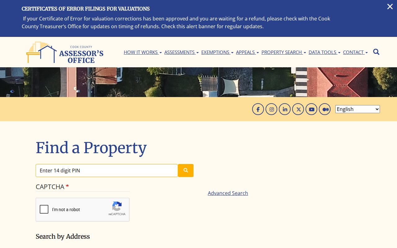
Its fields show why Lake and Cook searches cannot be treated as one roll.
Map Buffalo Grove Street Parcels
Village GIS uses “Enter Street Address,” then Property Summary, Government Representatives, Zoning Information, Map Gallery, and Property Tax Breakdown tabs. It bridges municipal and county records. A live parcel result was not captured, so only verified controls should be described.
Open the Buffalo Grove GIS search before reviewing its captured interface.
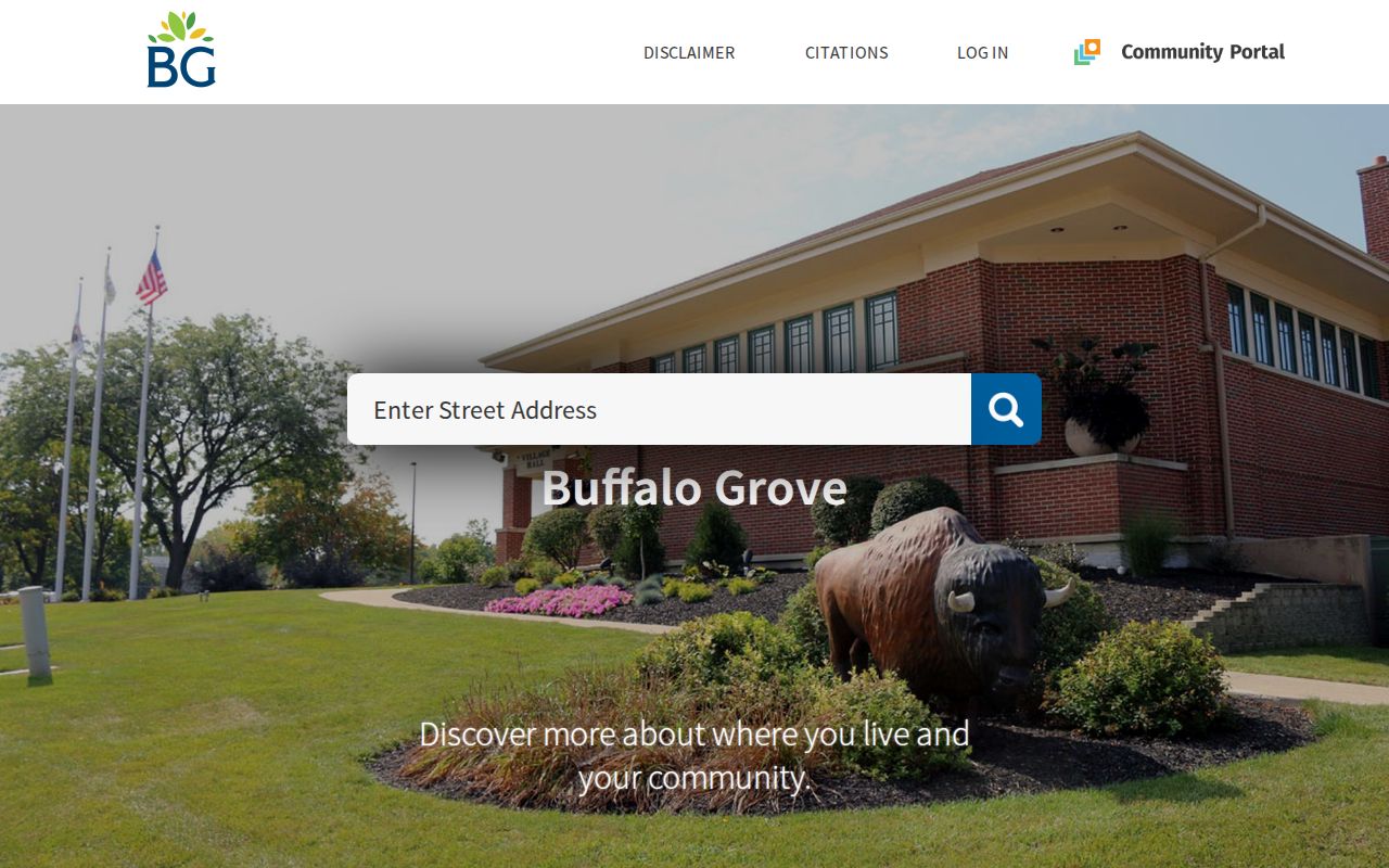
The tabs separate village zoning facts from tax and deed facts.
For Lake-side layers, use the Lake County GIS Maps resource.
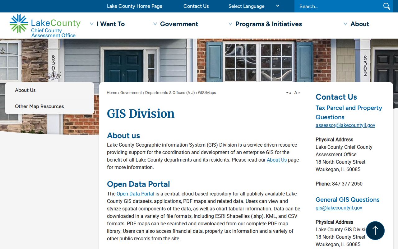
Keep the layer date and county source beside any map saved for Buffalo Grove research.
Buffalo Grove By-Address Records
Address sources do not carry equal weight. A parcel card describes taxation. A map describes land and districts. A deed records an interest. A permit describes approved work. Keep each Buffalo Grove street directory result tied to its keeper and date.
| Source | Keeper | What it supports | Access |
|---|---|---|---|
| Parcel card | Lake or Cook assessor | PIN, situs, tax name, values | Portal; office fallback |
| Parcel map | Village or county GIS | Shape, lots, zoning | Free map |
| Instruments | Lake Recording or Cook Clerk | Parties, date, legal description | Index, books, counter |
| Permits | Village Building & Zoning | Project and address clues | BS&A or FOIA |
| Historic source | LOC, library, museum, IRAD | Dated person or event link | Online or request |
The best chain runs from address to parcel, PIN and legal description, then recorded document and dated support. Voter lookup differs. It confirms one known registrant through name, birth date, ZIP, street number, and street name. It cannot create a Buffalo Grove street list.
Deeds Along Buffalo Grove Streets
The Lake County Public Record Search indexes recordings from 1980 forward. Quick and advanced searches accept grantor or grantee terms, date ranges, document types, and index or full-text scope. A grantor transfers an interest; a grantee receives one. Images follow recorder access rules.
Earlier Lake material uses handwritten Online Index Books and counter terminals. The office will not perform a title search. The Cook recording office describes online coverage from 1985 forward and historic holdings back to 1871. Older Cook work can require the Clerk, archives, or a written request.
Record number, type, date, party spelling, and legal description. If the street label changes but lot and block match, the legal description may preserve the trail.
Buffalo Grove Permit Address Trail
The BS&A property and permit search offers Address, Name, and Parcel Number routes, plus building, business, and advanced searches. Result pages returned an access error during research. Use the village permits page and a narrow Illinois FOIA request for a defined old file when the portal fails.
The official BS&A street directory screen appears below.
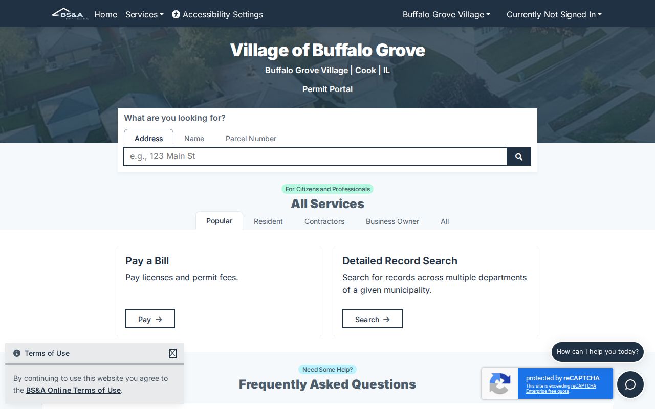
A permit can date work and may name an applicant or owner. It does not prove occupancy. Mailed zoning verification costs $150 and normally takes ten working days.
Read Buffalo Grove Address Terms
Small wording differences change a result. Preserve these fields instead of merging them into one address.
- Parcel
- A mapped piece of land with a county PIN.
- Situs address
- The physical property location.
- Plat
- A recorded map of subdivision lots, blocks, and easements.
- Legal description
- The formal land description in a deed.
- Criss-cross directory
- A book arranged by street and house number.
The tax mailing address receives correspondence. The postal address follows USPS delivery rules. Neither alone proves who lives at the situs.
Older Buffalo Grove Street Sources
No continuous Buffalo Grove criss-cross run was found. Verified Library of Congress regional White Pages include 1960/61, 1961/62, 1962/63, and 1964/65 locality-indexed volumes. They link listed subscribers to dated addresses, not full households. The Buffalo Grove city directory collections covers those books in depth.
Indian Trails identifies digitized Wheeling Independent issues and research appointments. Nearby-community papers can carry Buffalo Grove names. Raupp Museum objects, receipts, census, probate, and IRAD can fill gaps. Buffalo Grove’s 1958 snapshot was 164 people and 58 acres. Farm-era names may appear in county, township, store, church, or newspaper records rather than under a modern street.
Buffalo Grove HOA Street Ranges
The Village courtesy HOA list dated June 26, 2023 names Arbors, Cambridge on the Lake, Chatham Place, Country Court, Crossings, Fireside Terrace, Hillcrest, Sporline Farms, Villa Verde, and Woodland Commons. Some entries include Dundee Road, Mill Creek, Old Checker, Satinwood Terrace, and Weidner Road ranges.
Ranges can suggest a subdivision or nearby parcel set. They are not parcel boundaries, proof of membership, or guaranteed current data. Confirm the parcel in GIS.
Note: An HOA range narrows a neighborhood question, but only recorded parcels and the current association can confirm the relevant property.
Buffalo Grove Street Directory Limits
Public sources cannot reveal every household member, non-owner occupant, utility customer, delivery recipient, or protected voter. Illinois driver and title data is restricted. State voter lookup confirms a known person and does not allow street browsing. County voter files have eligibility and use limits, redact sensitive fields, and may omit protected people.
A missing name does not prove nonresidence. A listed name does not prove continuous occupancy. Confirm dates and use two independent sources. The Buffalo Grove resident lookup handles the one-person question separately.
Lawful use. Use Buffalo Grove address records only for lawful personal research. Never use a result to stalk, harass, threaten, or harm anyone.